
Cold easterly winds are sweeping in, frost and fog could settle across the landscape, and a few snowflakes might still make an appearance, yet for the majority of the UK, that classic white Christmas feels like a distant possibility right now.
As the holiday season ramps up, everyone seems to be wondering about the weather on December 25, with hopes pinned on a snowy backdrop to match the festive cheer. This year, the forecast paints a more nuanced picture, blending colder temperatures with limited chances for the white stuff many crave.
Recent weeks have seen relentless Atlantic storms dumping rain and causing disruptions, but a shift is underway, bringing a sharper edge to the air without the dramatic snowfall some might expect.
A Colder Turn for Christmas, Yet Mostly Dry
Meteorologists have their eyes on a robust high-pressure system building over Scandinavia, which is set to drift westward and influence the UK just as Christmas arrives, while lower pressure lingers over southern Europe and North Africa.
This configuration is pulling in brisk easterly winds from eastern Europe, delivering the kind of chill that defines proper winter weather in Britain, with temperatures dropping noticeably and nights turning crisp under frosty conditions.
The catch lies in the lack of significant moisture, as high pressure often keeps skies clearer and suppresses the formation of clouds or rain, meaning snow needs that essential ingredient to develop, no matter the cold snap.
For countless towns and cities, the day looks poised to unfold with dry spells, patches of brightness, and a biting cold that stands in stark contrast to the milder, wetter patterns we've endured lately.
This drier outlook offers some welcome respite for regions like Cumbria and south Wales, where recent heavy rains led to widespread flooding and forced communities to deal with road closures, evacuations, and cleanup efforts that have dominated headlines this month.
Spots Where Snow Might Still Surprise
Despite the slim overall odds, the door remains slightly ajar for wintry surprises in select areas, adding a layer of intrigue to the forecast that keeps weather watchers on alert.
Models indicate that southern coastal spots, such as the Channel Islands and perhaps the extreme south of England, could encounter bands of moisture edging northward from the continent, potentially mixing in sleet or light snow if timings align, especially across elevated terrain.
Up north, eastern Scotland stands out as another potential hotspot, where clouds from the North Sea might generate fleeting flurries over hills and peaks, even as the rest of the country stays mostly precipitation-free.
These instances would likely be brief and localized, far from a blanket of snow, but they underscore how unpredictable UK weather can be, particularly during this transitional phase.
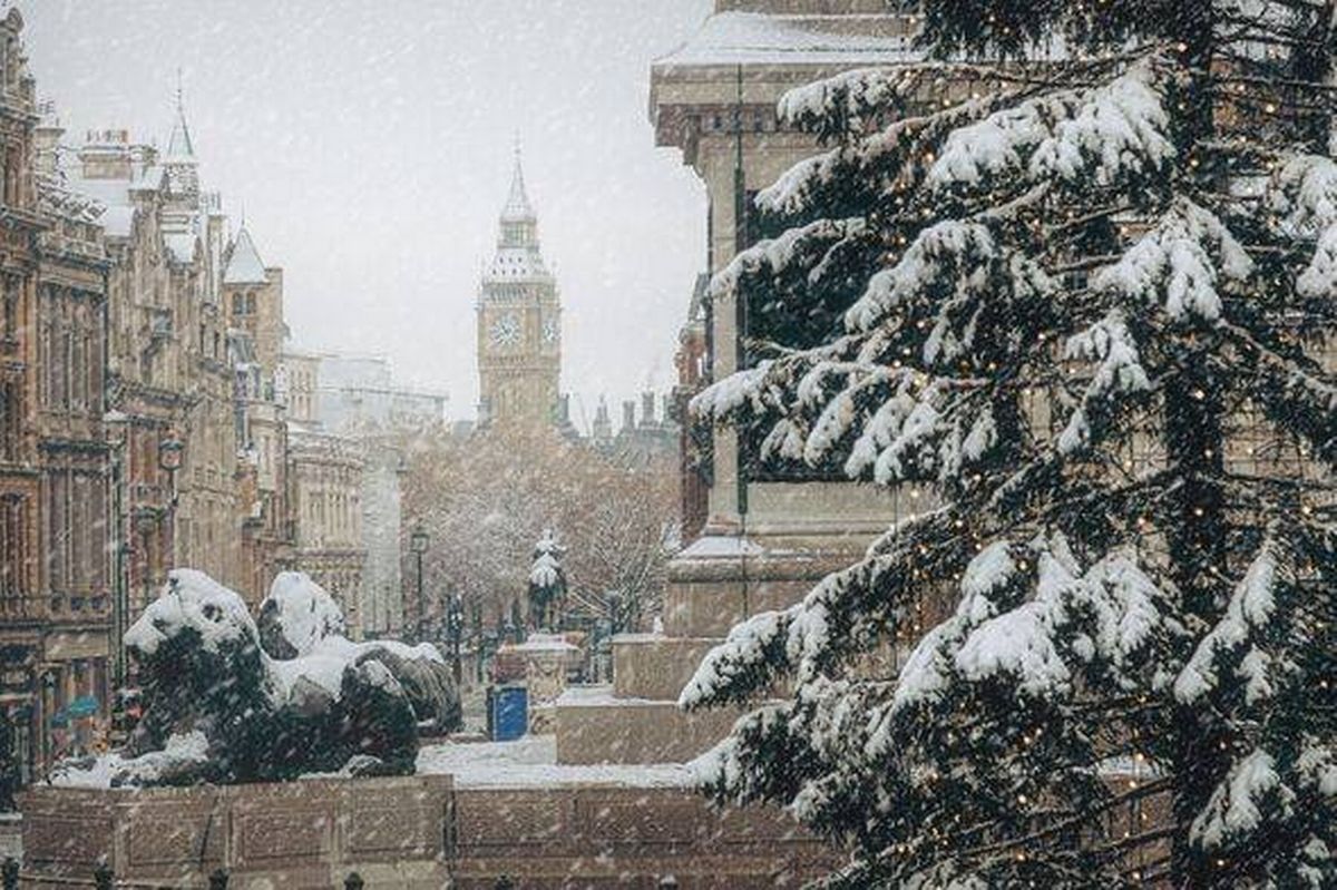
Big Ben under a blanket of Christmas snow, transforming London into a rare and magical white winter scene along the Thames.
The Festive Chill Beyond Snow
Snow or no snow, the atmosphere promises a distinctly wintry vibe, with clearer skies under the high pressure boosting the likelihood of widespread frost overnight, and calm winds fostering fog in valleys or urban lowlands that could create ethereal morning scenes.
Come Christmas Day, much of the UK might enjoy more sunshine than clouds, though southern zones could feel a touch breezier, delivering that invigorating December crispness that pairs perfectly with holiday gatherings and outdoor walks.
It's the sort of weather that evokes nostalgia for winters past, reminding us that the season's magic often stems from the shared warmth indoors rather than the conditions outside.
Defining a White Christmas – And the Odds
The Met Office sets a low bar for an official white Christmas, counting it if even a single snowflake falls at any of their 300-plus stations during the full 24 hours of December 25, regardless of whether it settles on the ground.
Historically, this has meant the UK logs a white Christmas more frequently than you'd think since 1960, but for everyday folks scanning their gardens or streets, the experience is far rarer and increasingly so amid shifting climate patterns.
Data from the BBC's review of Met Office records highlights how Christmas Day snow has grown scarcer across most sites, with the last major event in 2010 seeing flakes at 19 percent of stations and snow cover at a staggering 83 percent, a benchmark untouched since.
This year's setup leans toward isolated flakes at best, making widespread coverage a tough bet, though the cold front ties into broader trends of erratic winter weather we've seen in recent years, like the surprise snowstorms of early 2023 that blanketed parts of the Midlands unexpectedly.
Keeping an Eye on Updates
With UK weather known for its quick pivots, especially this close to the holidays, forecasters are monitoring every model run for potential tweaks that could tip the balance toward more wintry elements.
Any shifts will hit the BBC Weather platforms swiftly, ensuring everyone stays in the loop as plans solidify for family feasts, travel, or simply cozying up at home.
In the end, embracing the chill might just amplify the holiday spirit, proving that a touch of frost can make the season feel special even without a snowy flourish.
Weather Whispers: Common Queries Answered
How Has Climate Change Affected UK Christmas Weather?
Climate change has gradually warmed UK winters, reducing the frequency of sustained cold spells needed for widespread snow, while boosting the intensity of Atlantic storms that bring milder, wetter conditions instead. Experts note that events like the 2010 white Christmas are becoming outliers, with projections suggesting fewer frosty days ahead, though occasional polar air intrusions can still deliver surprises. This shift impacts everything from energy demands to wildlife patterns, urging communities to adapt holiday traditions accordingly.
What Are the Best Spots in the UK for Snow This Christmas?
Higher elevations often fare better for snow chances, so places like the Scottish Highlands, Snowdonia in Wales, or the Pennines in northern England could see light dustings if moisture aligns with the cold air. Coastal areas in the east might catch North Sea flurries, but urban lowlands remain least likely. Travelers eyeing these regions should check local forecasts, pack warm layers, and consider road conditions, as even minor snow can disrupt plans in hilly terrain.
Could Last-Minute Changes Bring More Snow?
Absolutely, as weather models refine over the next few days, subtle shifts in the high-pressure position could draw in more moisture from the east or south, potentially escalating flurries into something more substantial in vulnerable spots. Past years have shown how forecasts evolve rapidly, like the unexpected 2024 Boxing Day snow in the southeast that caught many off guard. Staying tuned to apps and alerts ensures you're prepared for any twists.